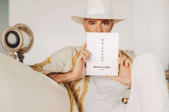


Faena Questionnaire: Dita Von Teese
Our rendition of the Proust Questionnaire.
Our rendition of the Proust Questionnaire.
From global excursions to intimate discussions and dynamic cultural engagements, the season has been nothing short of extraordinary.
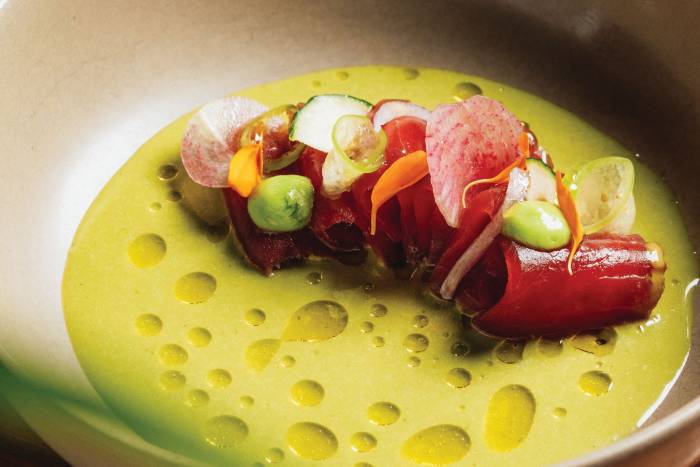
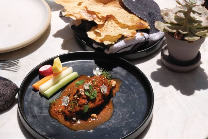
Spring is a time of renewal and creativity in the kitchen. As such, El Secreto has added exciting new dishes to the omakase menu that spotlight the season’s vibrancy and Chef Erik Melendez’s dedication to craftsmanship.
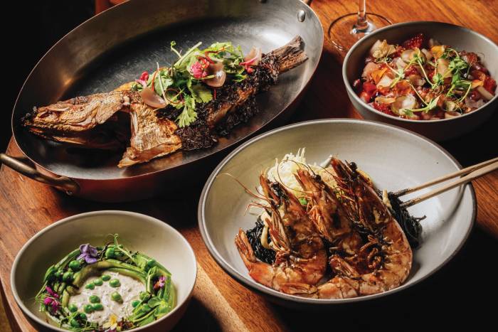
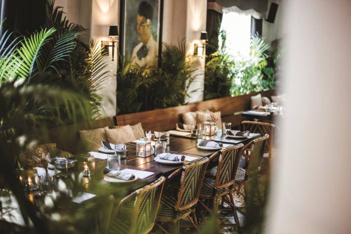
At Pao, renowned chef Paul Qui and his team craft dishes that merge Filipino traditions with international influences.
Campo, Casa Faena’s new sustainability focused restaurant, is led by talented Executive Chef Antonio Maldonado.
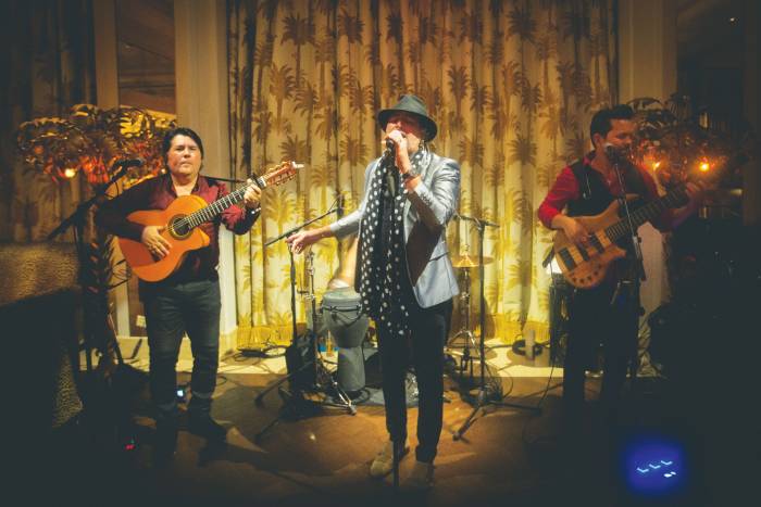
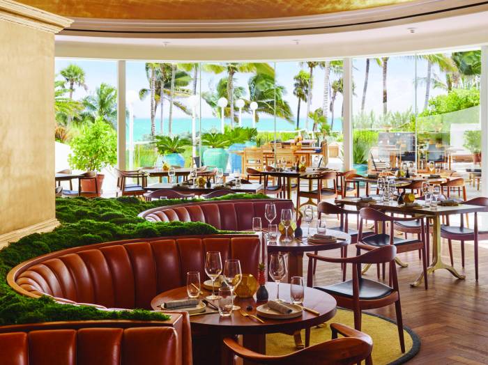
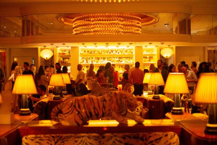
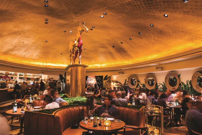
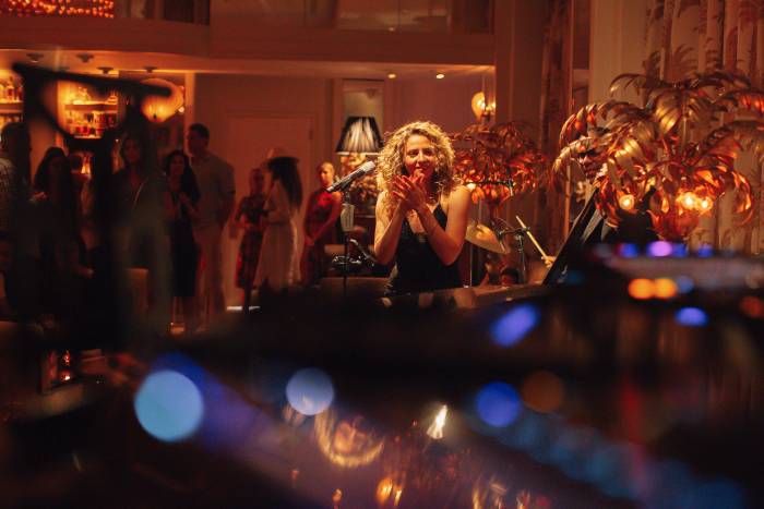
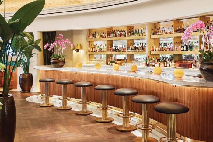
Every evening at The Living Room, live bands, craft cocktails and exceptional service create a multisensory experience that harmonizes with Faena Miami Beach’s inimitable ambience that flawlessly integrates music, art and design.
Tierra Santa Healing House offers individualized skincare treatment using Biologique Recherche’s clinical approach to personalized skincare.
Faena Theater launches RETRO, an electrifying celebration of the music that has shaped generations.
Faena Theater continues to redefine live entertainment in 2025 with a sensational season of programming.
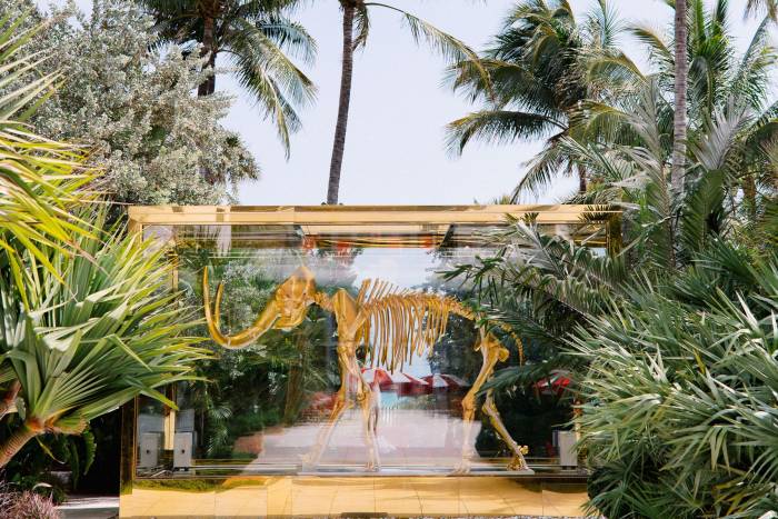
Faena District Tulum is a new hub for sustainable living, a place to elevate the mind and spirit, to achieve a greater state of being, and to contribute to the development of a new and better society.
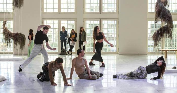
Last December, Nomadic Journey and Spirit of Places brought Marina Abramović’s extraordinary artistry to the Faena Art Project Room, celebrating over four decades of groundbreaking work.
A Journey into Florida’s Wilderness Through Color and Light
The pioneering British DJ, producer, and musician helped shape the “big beat” genre in the 1990s with energetic live performances and chart-topping hits like Praise You and Right Here, Right Now. With a career spanning over three decades, Fatboy Slim continues to influence global dance culture through his innovative sound and dynamic stage presence.
We enhance and enrich the lives of our members by bringing them the world’s best programming and talent by building true community.
Inspired by the essence of fresh countryside living and dining, Campo emerges as a beacon of sustainability and culinary artistry. Chef Antonio Maldonado, Campo’s Executive Chef, brings Alan Faena’s philosophy to life, presenting a dining experience rooted in regenerative practices and local, sustainably sourced ingredients.
Our rendition of the Proust Questionnaire is a unique take on the famous parlor game that gained popularity, although it was not originally created by Marcel Proust, the renowned French essayist and novelist.
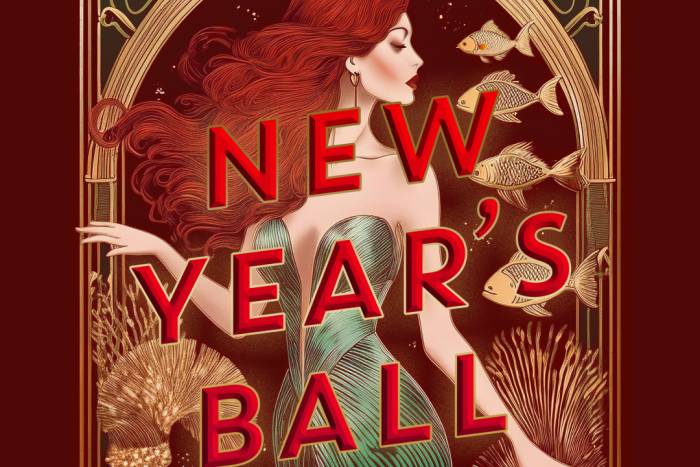
Each year, Faena elevates the holiday season with a lavish party with an avant-garde twist, making it one of the most sought-after destinations to ring in the New Year.
Every weekend, Los Fuegos pairs a menu of special entrées with a distinctive cocktail selection that diners can sip while enjoying high-caliber entertainment in The Living Room lounge.
New technology is being used to optimize workouts while a variety of healing retreats are the perfect way to conclude or start the year.
Carmen is a new production brought to life by Quixotic at Faena Theater—and it delivers on every level.
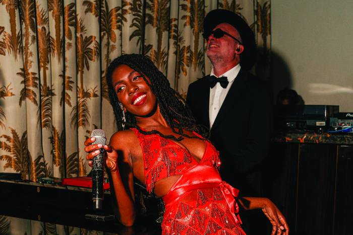
As high season begins, The Living Room will feature a roster of stalwart female vocalists whose latenight performances will be backed by the Black Hat Band and burlesque performers led by Elena Lee.
Faena is expanding its unique vision from Miami Beach to the heart of Miami through a multi-phase cultural district, set within the only 14-acre private park along the Miami River.
More than 520,000 Condé Nast Traveler readers rated their favorite travel experiences across the globe, voting Faena Miami Beach as the number one hotel.
Known for its visionary approach, Faena Art consistently curates immersive, thought provoking experiences that merge contemporary art with performance and architecture.
Our rendition of the Proust Questionnaire is a unique take on the famous parlor game that gained popularity, although it was not originally created by Marcel Proust, the renowned French essayist and novelist. Proust believed that by responding to these questions, individuals unveil their genuine essence.
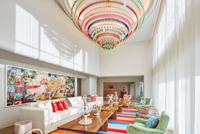
Faena Rose is an exclusive private members’ club dedicated to art and culture, founded on the principles of community, cultural enrichment, patronage, and VIP access. Its mission is to enrich members’ lives through world-class programming and to foster a genuine sense of community.
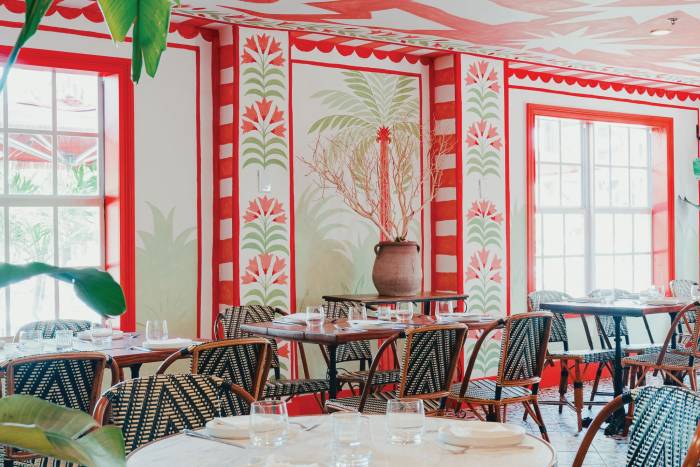
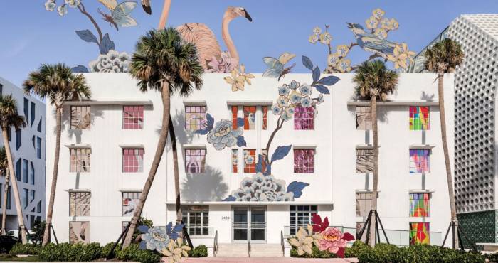
In anticipation of a new restaurant opening at Casa Faena this fall, Brazilian artist João Incerti has created a vibrant tropical oasis in the hotel’s dining room with his mural titled “Let the Sun Come In.” We spoke with Incerti about his artistic journey and the inspiration behind this stunning artwork.
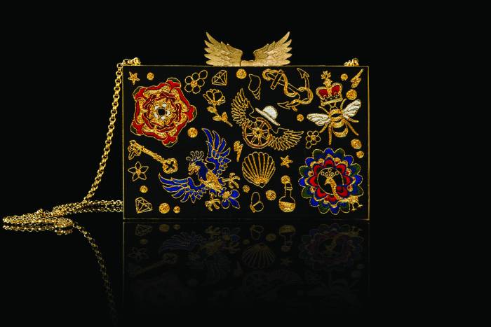
Big Bang has a new influx of one-of-a-kind crafted designs from around the globe. Offerings span from vibrant jewelry and handbags to exclusive swimwear and ready-to-wear pieces, each telling a unique story of craftsmanship and creativity
For the months of August and September Miami Spice brings a culinary spectacle to Los Fuegos offering an unforgettable dining experience that encapsulates the essence of Argentina’s finest flavors and its mastery of fire-based cooking.
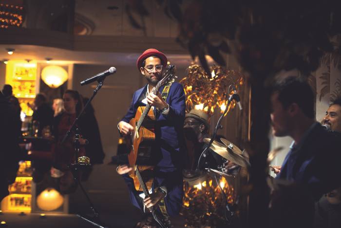
In The Living Room, music reflects the soul of Miami’s vibrant energy. Resident acts from Alfredo Rivero’s American Gipsy to music from Liset Alea, a founding member of the Parisian bossa nova band Nouvelle Vague, captivate audiences on a weekly basis
Restaurant Pao by Paul Qui is redefining seasonal dining with new summer ingredients, an art-inspired cocktail menu, a new wine class, and a must-try Miami Spice menu.
Promising a summer of delicious discovery, El Secreto’s chef Erik Melendez is launching an interactive two and-a-half-hour sushi-making class this summer.
From cryotherapy and hydrating IV drips to summer facials and seasonally priced Miami Spa Months treatments, Tierra Santa offers a myriad of ways to cool down when the heat is high.
In a bold and original move, Faena Theater is set to present a formidable cabaret rendition of Georges Bizet’s 19th-century opera “Carmen,” reimagined by the creative minds at Quixotic, an award-winning performance art collective.
The inception of Faena’s grand vision can be traced back to his home and rose garden in Punta del Este, Uruguay, affectionately nicknamed ‘Tierra Santa,’ or sacred ground. “Tierra Santa was a special...
In this first 20th anniversary of the opening of Faena Buenos Aires, the Alchemist, multidisciplinary artist and filmmaker, tells us about that dreamlike landscape in distant lands where magic was born.
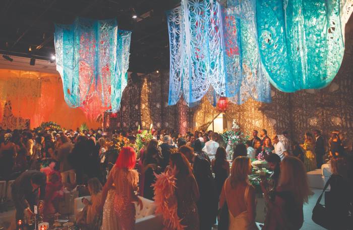
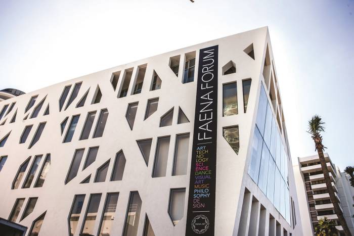
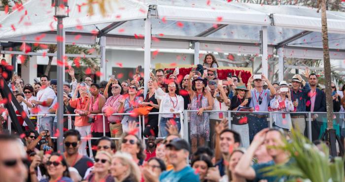
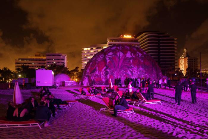
On May 10th, Faena Art hosted its Annual Art Gala. A night where art and community convened in the Faena Forum for the “Garden of Earthly Delights,” an evening of creative expression, art installations, top chefs, and musical performances.
Our rendition of the Proust Questionnaire is our unique take on the famous parlor game that gained popularity, although it was not originally created, by Marcel Proust, the renowned French essayist and novelist. Proust held the belief that by responding to these questions, individuals unveil their genuine essence.
In anticipation of a new restaurant opening at Casa Faena this fall, Brazilian artist João Incerti has created a vibrant tropical oasis in the hotel’s dining room with his mural titled “Let the Sun Come In.” We spoke with Incerti about his artistic journey and the inspiration behind this stunning artwork.
Summer is sizzling in the Living Room with a crop of talented artists putting their singular stamp on Faena’s curated music lineup.
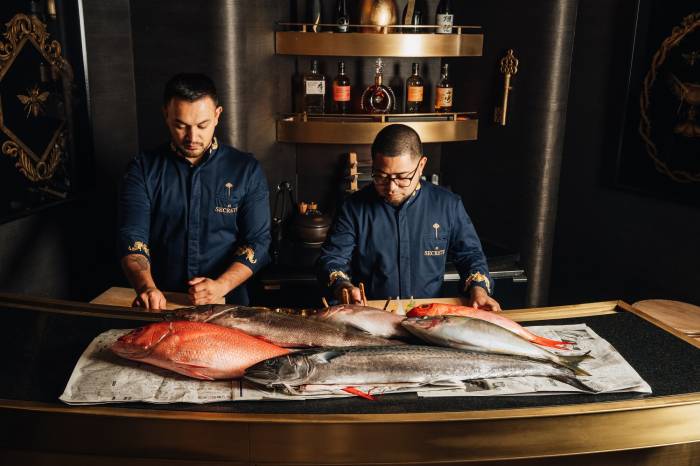
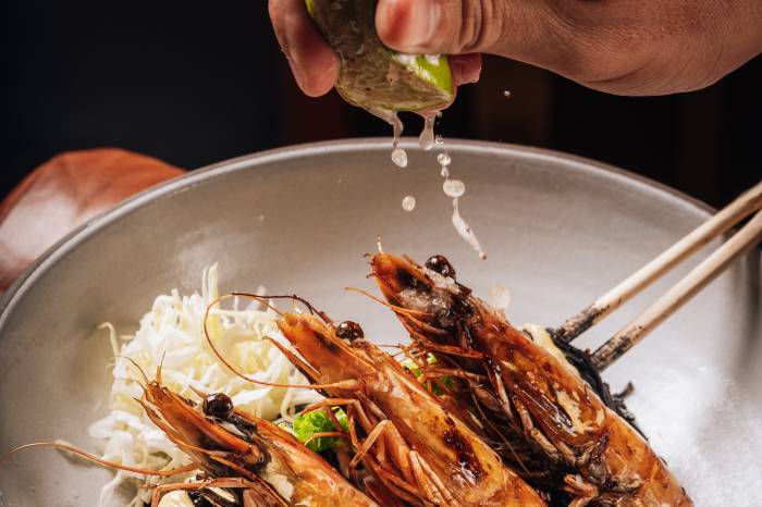
A city surrounded by sea, Miami is known for its line-caught catch, which chef Paul Qui sources from local purveyors. To taste the finest fruits of the sea, head to Pao for a Bossa Nova Sunday brunch.
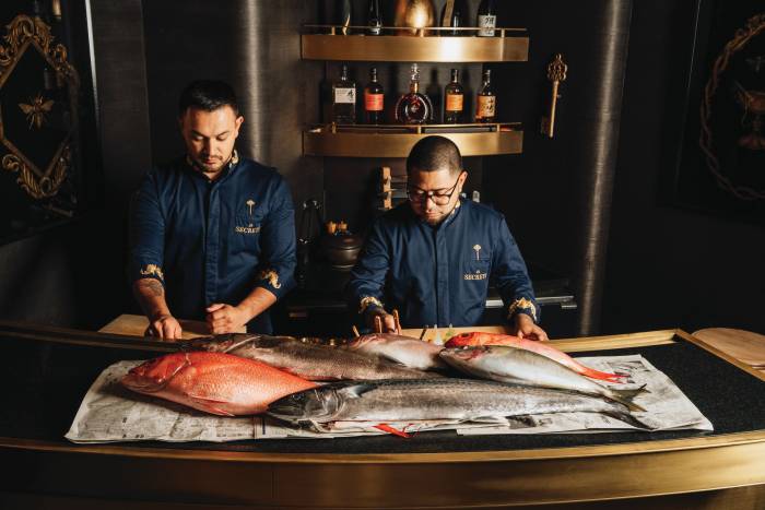
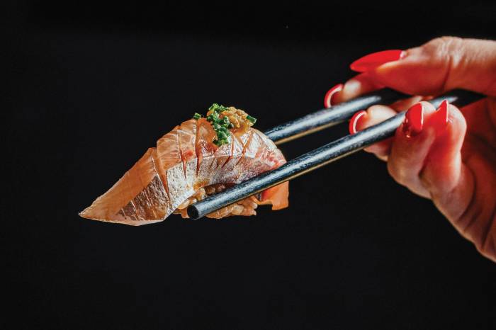
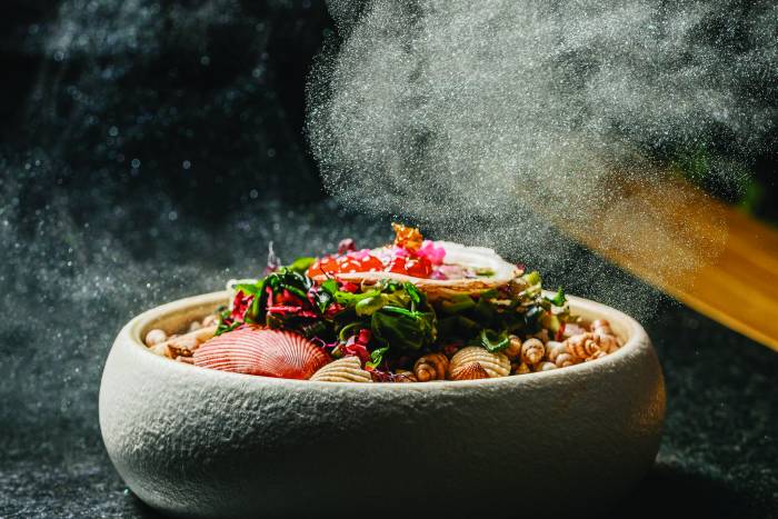
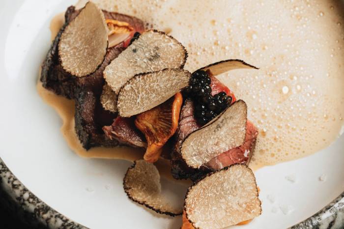
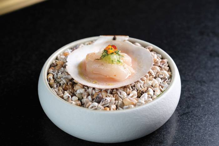
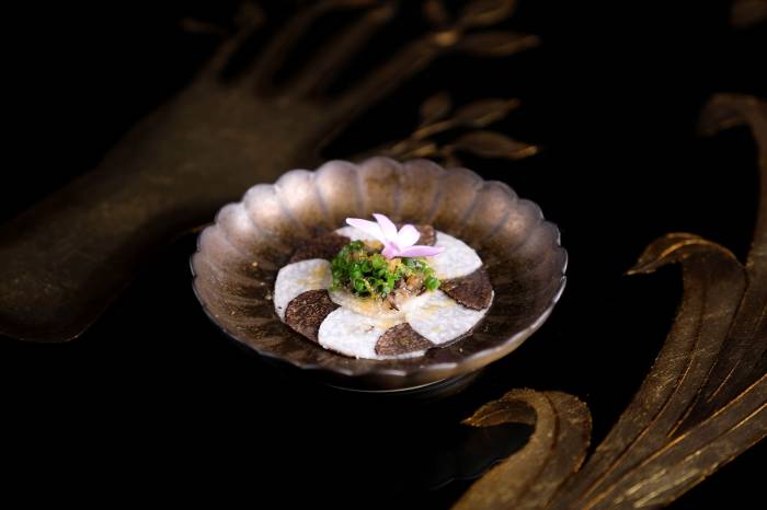
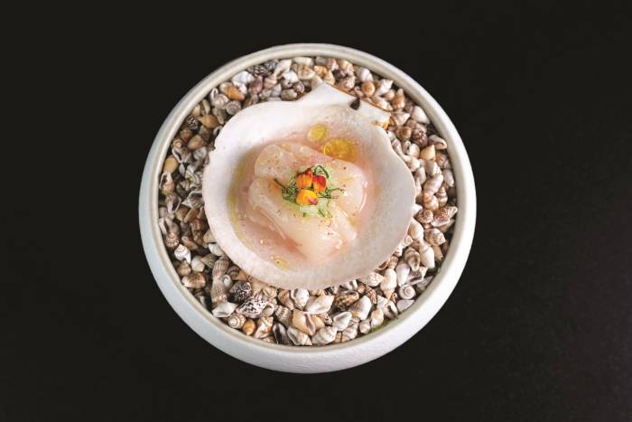
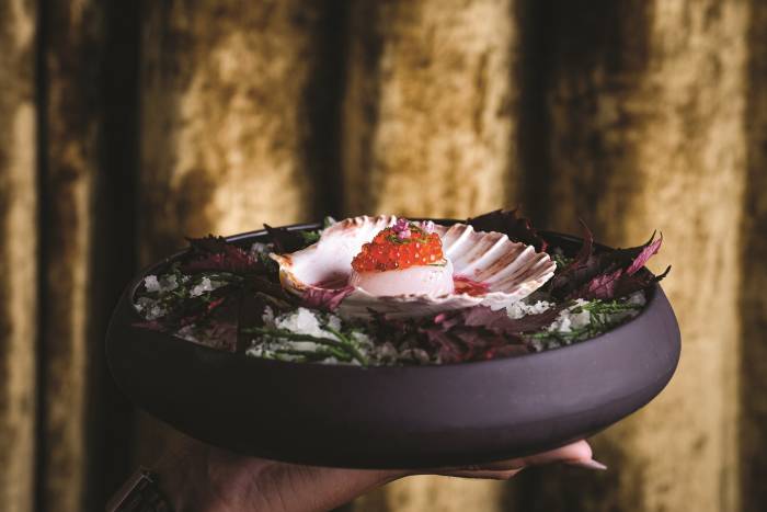
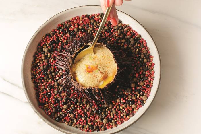
Miami is becoming an epicenter for standout omakase experiences known for high-quality ingredients, creativity, and a stylish ambiance. Leading the pack is Faena’s El Secreto, a six-seat speakeasy with a Japanese menu that changes seasonally.
As the mercury rises this summer, head to Tierra Santa Healing House to embrace the chill of cryotherapy for a refreshing summer boost.
Faena Theater’s summer events calendar is packed with world-class entertainment from comedy legends and notable jazz musicians to cabaret starlets.
Strap on skates and spend the weekend rollerdancing to live DJs at Faena Forum. Guests of all ages are welcome to experience the roller rink installation that has become a fan-favorite in Miami.
This season Faena Art will host its annual fundraising gala where art and community convene in the Faena Forum for an unparalleled night of creative expression, art installations, top chefs, and musical performances.
Our rendition of the Proust Questionnaire is our unique take on the famous parlor game that gained popularity, although it was not originally created, by Marcel Proust, the renowned French essayist and novelist. Proust held the belief that by responding to these questions, individuals unveil their genuine essence.
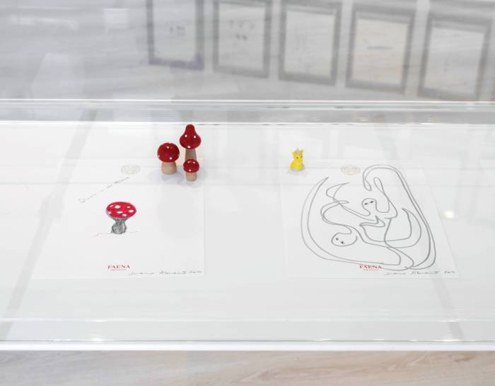
Artist Alessandro Florio, born in Taormina, Sicily, initially immersed himself in the artistic environment through the world of tattoos, a passion that deeply resonates with him. The connection between painting and tattooing lies in his need for the most intimate form of expression, allowing him to vividly convey his emotions.
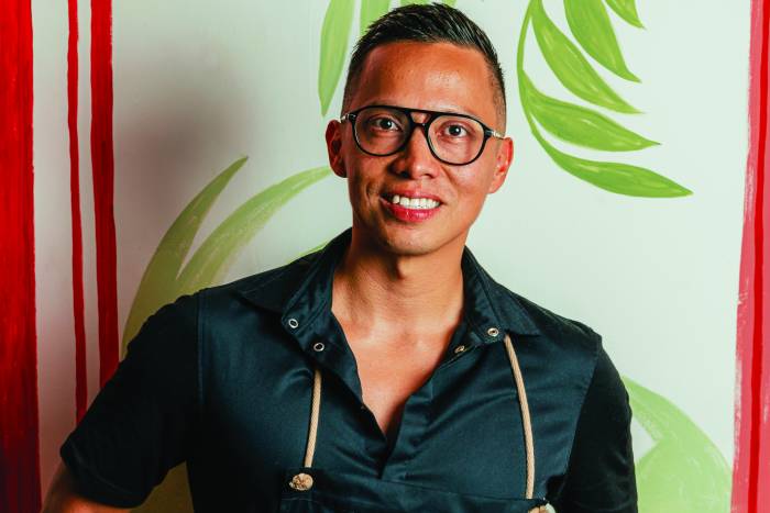
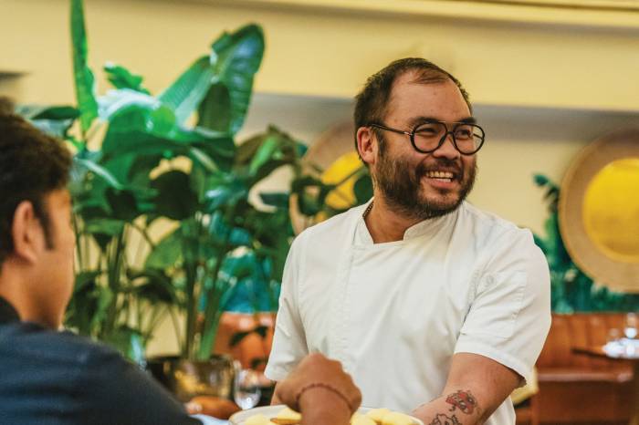
Erik Menedez, the innovative chef behind Paul Qui’s El Secreto Omakase, Faena’s six-seat speakeasy dining experience, shares his secrets of the season.
Argentine DJ and producer Richie Hell is putting his spin on The Living Room’s music scene.
Faena is a meditation on love in all its forms. Every detail in every space is infused with passion, care, and a deep appreciation for timeless beauty.
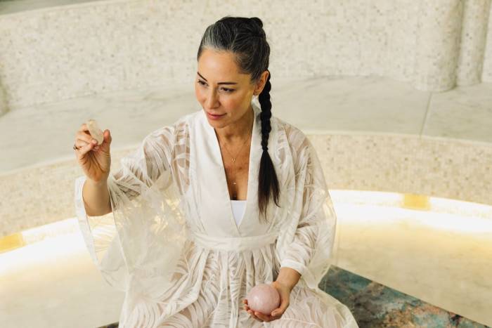
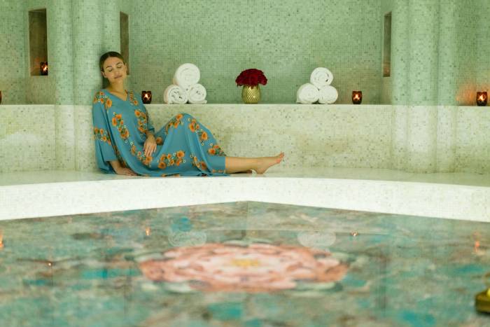
Tierra Santa Healing House blends sophisticated treatments and smart technology in the purest and simplest of settings. Each day, Faena’s team of experts opens the door to a new beginning, an opportunity to change your life, improve your health, and enhance your body.
Faena launches its 6th Annual Jazz Series at the Faena Theater with a lineup of seven fantastic shows produced and curated by Grammy-nominated record producer and artist, Rachel Faro.
New York siren Rocky Lanes is launching EVERAFTER, that will unfold once a month at Faena Theater. As the master of ceremonies, Lanes will entertain the crowd with her showstopping vocals within an immersive club experience featuring red-hot performances from her chosen coterie of international artists.
During Miami Art Week 2023, more than 50,000 art enthusiasts lined up to see Faena District’s four provocative installations collectively titled ‘Spaces of Influence: Shaping Community in the Modern World.’ Supported by Faena Art, the exhibition explored the tension between community and individuality, technology and tradition, power, and grassroots.
Join us on an intoxicating journey into the multiverse with Faena Theater’s acclaimed contemporary cabaret Allura!
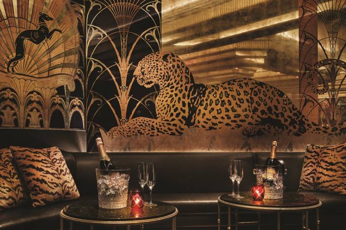
A hidden gem tucked inside Faena Miami Beach, La Cava is an immersive wine room hosting special candlelit events paired with a carefully curated collection of 3,000 wine bottles showcasing varietals from every corner of the globe.
A new spa menu, multiday retreats and guided meditations at Tierra Santa Healing House are designed to support spirit, mind, and body throughout the holiday season. There’s also a host of purifying treatments and experiences to help transition guests into the new year feeling grounded and refreshed.
Every few months, chef Erik Melendez evolves the omakase offerings at El Secreto with new in-season ingredients to ensure the menu is always full of secrets and surprises.
If you’re craving the perfect bite, look no further than Pao by Paul Qui. The Asian-inflected restaurant recently added an entirely new section of Pao Bites and nigiris to the menu.
Our rendition of the Proust Questionnaire is our unique take on the famous parlor game that gained popularity, although it was not originally created, by Marcel Proust, the renowned French essayist and novelist. Proust held the belief that by responding to these questions, individuals unveil their genuine essence.
Every year, Condé Nast Traveler magazine polls more than 500,000 of its readers on their favorite places for the prestigious Readers’ Choice Awards. Travelers from around the world voted Faena Buenos Aires as the best hotel in all South America, and Faena Miami Beach the number one hotel in Miami.
Faena Art announced its public programming for Miami Art Week 2023, presenting four major installations by artists Sebastian Errazuriz, Beeple, and Kelly Breez; collectively titled ‘Spaces of Influence: Shaping Community in the Modern World.’
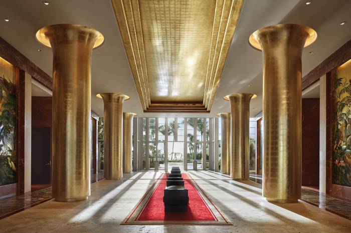
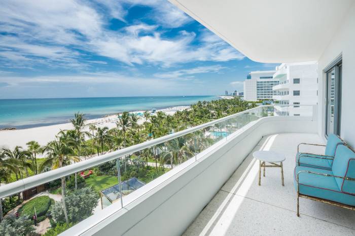
World-class hotels and luxury vehicles meet at the intersection of elevated hospitality. At Faena Miami Beach, you get both. Guests staying at the hotel can hop in a Lincoln Navigator, the brand’s flagship full-size SUV, to discover the sights of South Beach.
When celebrating a special day or hosting a corporate event, we all want something extraordinary. Faena’s events team specializes in out-of-the-box experiences that are nothing short of unforgettable.
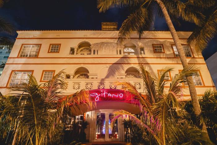
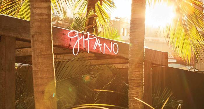
Born in the lush jungles of Mexico, Gitano stocks its shelves with the finest mezcals and tequilas from Oaxaca to Jalisco.
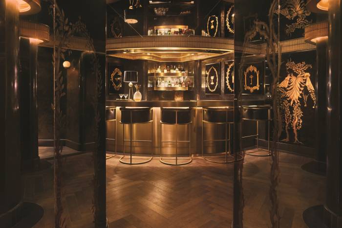
Slip into Saxony Bar where Art Deco allure and cocktail craftsmanship are an ode to the artistic spirit that flows through Faena’s veins.
Dining at El Secreto, Faena Miami Beach’s speakeasy omakase bar comes with a few new surprises.
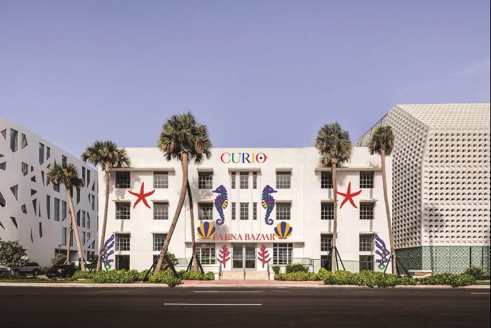
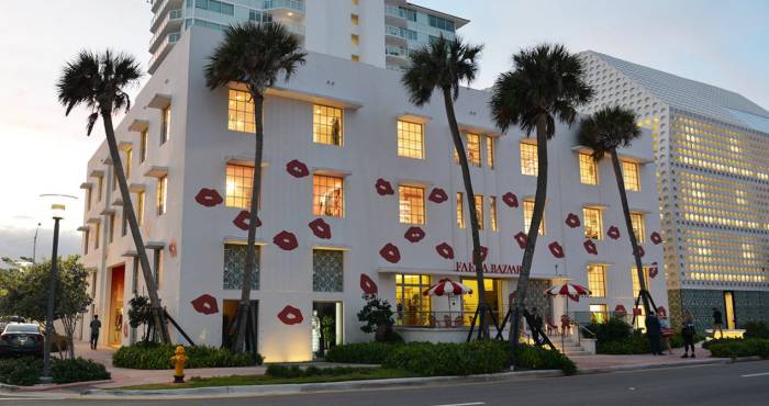
As the world’s leading designers prep for fashion week, Jeffrey Lasota from Curio at Faena Bazaar speaks to Miami’s hottest trends from minimalist and denim to mesh and beyond.
During Miami Spice, an annual culinary celebration that happens every August and September, gastronomes can satiate their taste buds at the city’s best restaurants with delicious three-course menus at discounted prices. At Los Fuegos and Pao, diners can take a fiery journey through ember-roasted fare that leaves palates aflame with delight.
Known for its cutting-edge cabarets, annual jazz series, and outstanding musical performances, Faena Theater hosts top talent from around the world to offer Miami’s finest live entertainment.
Come for a musical multiverse and stay for a tropical getaway in one of Miami’s most celebrated hotels.
Looking to refresh your summer skin? Tierra Santa Healing House specializes in Biologique Recherche facials and full-body scrubs that will leave you glowing from head to toe.
Anabella Bergero’s art installation Heart of Community, on view in Faena Art’s Project Room, has been extended through October 14. The colorful multimedia installation explores female identity in the Latinx community through a transdisciplinary approach of fashion, photography, collage, textiles, and community programming. Faena Art sat down with the artist to discuss her work and the community’s response to it.
Shop breezy summertime silhouettes at Curio at Faena Bazaar that will make you stand out this season.
“Miami Beach in the summer is hot, steamy, and sexy, and no place more so than Gitano Miami Beach in the Faena District,” said Gitano founder, James Gardner.
Every night of the week talented local musicians light up the Living Room with live music across genres. There’s Gypsy Jazz from French Horn Collective, Latin classics from Mi Dulce Son, and big band songs from crooner Louis Amanti. On select Thursday nights, guests can groove to Los Wizzards and their signature brand of Miami funk that blends elements of funk, rock, pop, jazz, reggae, hip-hop, and salsa.
Every two months chef Erik Melendez and sous chef Carlos Islava conjure up 17 new tasting dishes at the six-seat omakase bar El Secreto that respect traditional Japanese preparations, but come with a kick of spicy flavors that showcase their Latin roots.
Championing sustainability and zero waste, the chefs at Pao by Paul Qui use different fermentation techniques to extend the life of short-season ingredients transforming them into palate-pleasing flavors with a whole new profile of tasting notes.
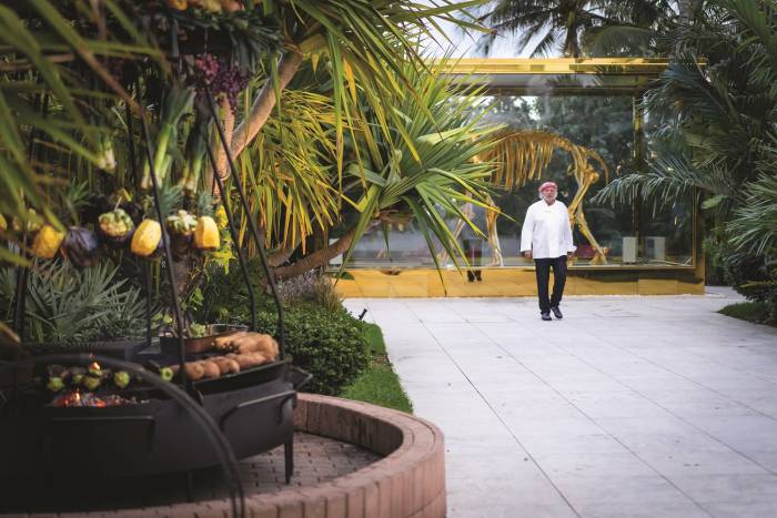
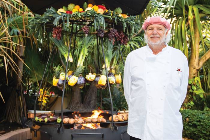
Cooking with fire is an essential part of Argentina’s culture. By emulating his mentor Francis Mallmann, chef Sebastián Benítez is sharing his country’s traditions at Faena Miami Beach’s Los Fuegos restaurant.
At Allura, Faena Theater’s latest cabaret, New York siren Rocky Lanes and Cuban guitarist Alberto Torres showcase an effervescent musical chemistry that is raw, authentic, and utterly irresistible.
Multi-grammy award-winning musician John Daversa brings his big band sound to the Faena Theater stage this summer, while the Wednesday night Jazz Series is in full swing.
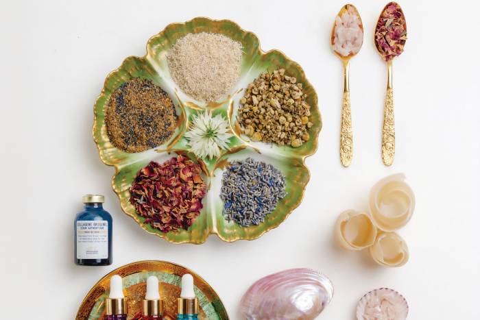
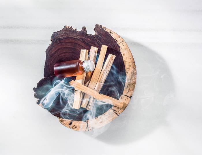
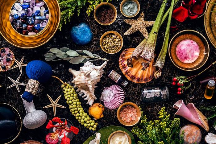
Essential oils have been used for thousands of years for their potent healing properties. Tierra Santa Healing House’s range of all-natural, hand-blended sacred oils are used to cleanse and energize the body in a range of spa rituals.
Faena celebrates a handful of exciting recognitions ranking it among the top hotels in the United States.
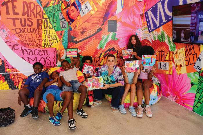
This April, multi-award-winning Latinx fashion designer Anabella Bergero launched Heart of Community at the Project Room—a dynamic exhibition that will run through July showcasing textile art, fashion design pieces, collage, and digitally printed murals that together create a Latinx Pop visual universe.
Miami has no shortage of sex appeal, but this spring season will be even hotter with the arrival of several new brands to Curio at Faena Bazaar.
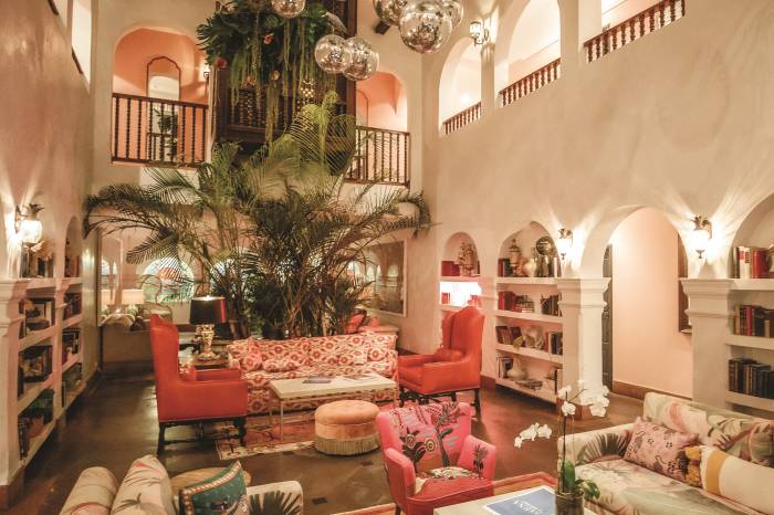
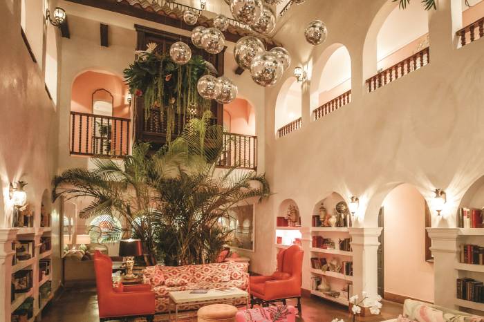
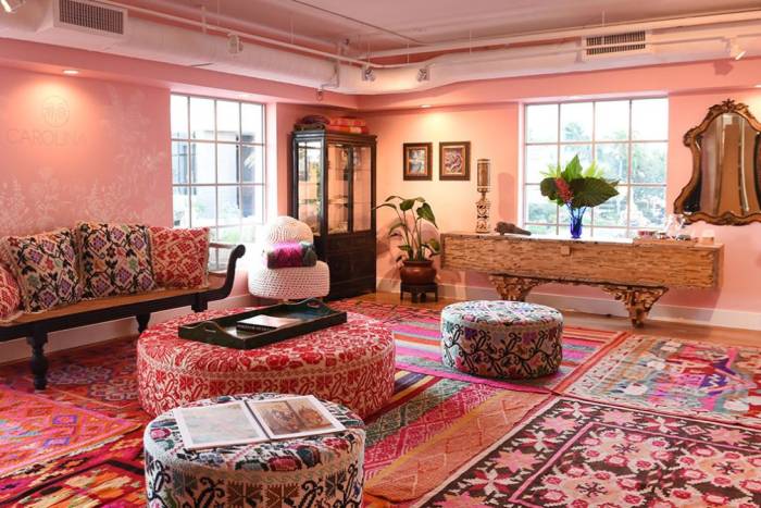
Book a spring reset at Casa Faena, Miami Beach’s most charming boutique hotel. An intimate Spanish Colonial gem just steps from the beach; Casa Faena houses Mediterranean-chic guest rooms, an artfilled atrium, and the see-and-be-seen GITANO restaurant.
New bands, fresh faces, and showstopping performances are coming to the Living Room this spring.
Every February, the nation’s top chefs descend on Miami for the South Beach Wine & Food Festival, a culinary bonanza of more than 90 events celebrating all things epicurean.
“Our focus at El Secreto is simply to bring the best products from the world to this intimate omakase experience,” said chef Paul Qui.
When it comes to seafood, sourcing is everything. When it comes to seafood towers, where the offerings are unadulterated by heavy sauces or marinades, sourcing is everything and then some. At Pao, James Beard Award-winning chef Paul Qui is obsessed, in the best possible way, with where his seafood comes from.
Choreographer Milena Straczynski lifts dance off the stage and defies gravity in Allura, Faena Theater’s transfixing cabaret from performance art collective Quixotic.
Tierra Santa Healing House taps into the potential of spring with a calendar of community-driven events that nurture fresh beginnings, spur spiritual growth, and welcome abundance in all its forms.
When you winter in paradise, enjoy an extra night on the house at Faena Hotel Miami Beach. Turn a long four-day weekend into five with more time to lounge in the sunshine on a beachfront daybed, sip...
Christina Pettersson brings Take This Waltz, a gothic exploration of Miami’s environment, mythology, and decline, to the Faena Art’s Project Room.
Forbes Travel Guide (“FTG”), the only global rating system for luxury hotels, restaurants, spas and ocean cruises, today announced its 2023 Star Awards. Faena Hotel Miami Beach earned a new Forbes...
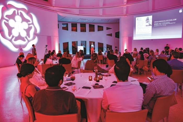
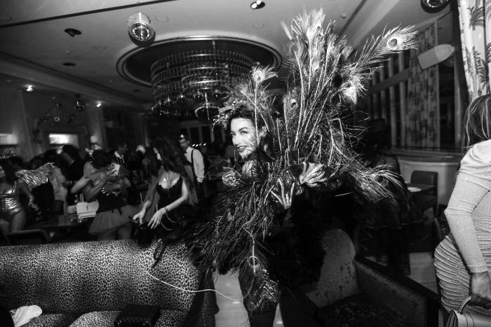
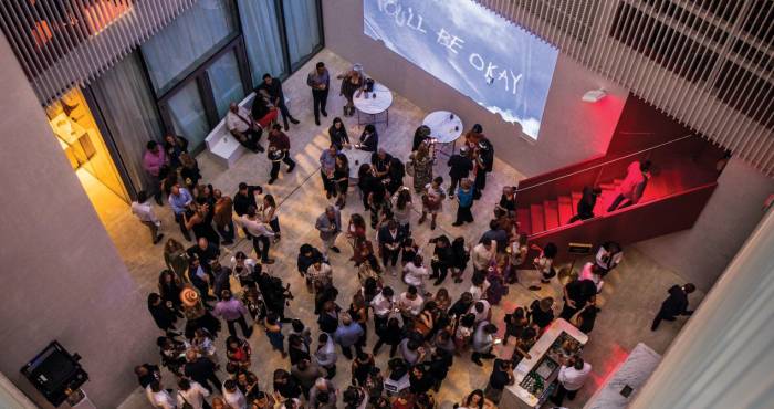
Miami’s exclusive art- and culture-based private members club offers an unparalleled roster of diverse events and extraordinary experiences to a dynamic, engaged community. Here is a snapshot of recent events.
Raise a glass to the holiday season at Casa Faena, where legendary playwright Tennessee Williams once stayed and famously introduced a toast at sunset. The hotel’s historical roots are reflected in its Spanish Colonial architecture dating back to the 1930s, best showcased in the property’s sun-drenched courtyard atrium, wrought iron balconies, and terracotta touches.
Faena's Music Director Alejandro Lista has spent years honing the music menu in The Living Room where a roster of live bands and DJs across genres performs nightly. As the weather cools, Lista heats things up with knockout acts from Miami's top musicians.
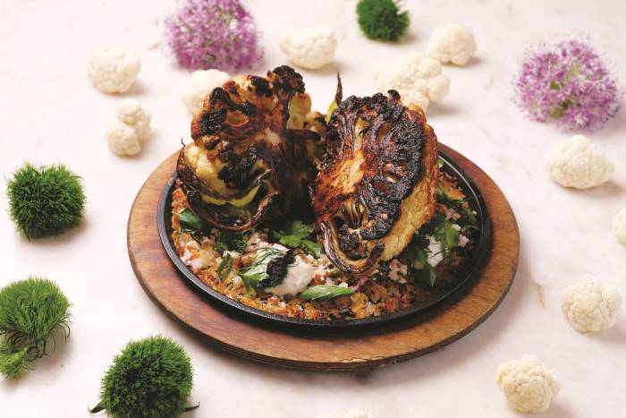
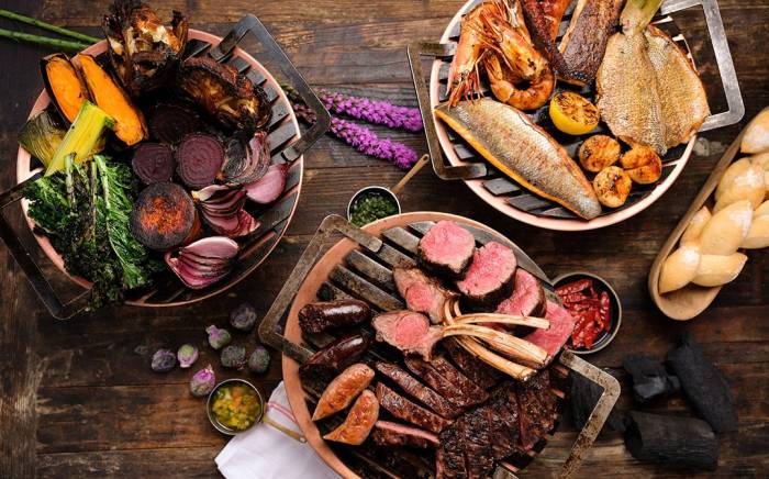
The fine dining temple of Los Fuegos from Argentine grillmaster Francis Mallmann is where one can find a bounty of flavor-packed vegetables smoked, grilled and charred to perfection. The restaurant's latest menu takes inspiration from the chef’s recently released vegetarian cookbook: Green Fire.
“What keeps bringing me back to El Secreto is that the food and atmosphere are a surprise every time. It’s never the same, ”said Amanda Diem, a Faena Rose member enjoying a 16-course omakase tasting menu at the six-seat onyx and gold-leaf bar.
James Beard Award-winning chef Paul Qui levels up the dining experience at Pao with a new sustainably sourced seafood program including a crudo bar and a fresh take on his Asian- inflected menu.
The winter season at Tierra Santa Healing House is a time for retreating inward, for replenishment, and for reflection.
Roll out the red carpet for your family this holiday season in Faena’s dreamy collection of suites or the exclusive two-story penthouse with unrivaled views of Miami Beach.
Colombian womenswear designer, Silvia Tcherassi's spring 2023 collection brings a bright autumn color palette and new seasonal classics made with innovative materials to the ready-to-wear mix at Faena Bazaar.
If you’re looking for a great party in Miami, singer Rocky Lanes is emceeing the best one in town. Allura, Faena Theater’s new vanguard cabaret, is an invitation to the starlet’s multiverse where her vocals alchemize with live guitar riffs from Cuban instrumentalist Alberto Torres and a choreographed ensemble of magnetic performances.
"This year's unparalleled programming during Miami Art Week 2022 is a testament to our long-lasting commitment to innovative cultural production," said Alan Faena.
Miami's exclusive art- and culture-based private members club offers an unparalleled roster of diverse events and extraordinary experiences to a dynamic, engaged community. Here is a snapshot of recent events.
Faena Forum, an OMA-designed architectural gem with a centerpiece oculus and a stunning rose marble amphitheater, has played host to Miami's most exclusive weddings, no two alike.
Chef Reiji Yoshizawa turns to his Filipino Japanese roots and international culinary experience to put his own unique stamp on El Secreto's speakeasy omakase experience.
Throw on a hooded cape, pack your scepter and prepare for an evening of supernatural pleasures where crystal balls reveal metaphysical mysteries and the unseen becomes seen.
Faena Bazaar is more than just an experiential destination for established and emerging designers. It's a lifestyle hub dedicated to optimum wellness.
Curio at Faena Bazaar dazzles with high summer fashion, from the best bathing suits for every body type to perfect seasonal ensembles and chic accessories for men and women.
Francis Mallmann’s latest cookbook ‘Green Fire’ puts garden-fresh fruits and vegetables to the mercy of the flame until they’re utterly irresistible.
New this season is a whimsical bridal corner adorned with giant roses. Guests will find hand-embellished gowns from the House of Matching Colors, a couture brand founded by the store’s curator Paula Selby Avellaneda.
Faena Theater’s risqué revue Tryst Cabaret welcomes a formidable new voice to the stage. Sunni Stephens is teaming up with sensational emcee Kat Cunning for a sultry summer series that will seduce you with tales of love, lust, & intoxicating passion.
Into the Great Dying: Waters We Share, the latest site-specific installation at Faena Art’s Project Room from Brazilian environmental artist Beatriz Chachamovits, immerses viewers in the beauty, fragility and destruction of the ocean’s coral reefs.
Considered one of the most prestigious art prizes in the Americas, the award is a catalyst for innovative, site-specific and immersive works that transcend the traditional boundaries of art, science, technology, philosophy, and social practice.
This season, shop Curio at Faena Bazaar for simplistic fashions with a touch of luxury at Michael Ward and Manel Garcia Espejo’s clothing label. Michael has spent his career at the helm of fashion brands like Carmelo Pomodoro, Burberry, Anne Klein, Rachel Zoe and Diane von Furstenberg.
Pao’s Sous Chef Mauricio Quezada highlights three new dishes on the restaurant’s acclaimed pan-Asian menu with sommelier-recommended pairings.
“We are always introducing new brands and designers,” says Danielle Licata, co-founder of Curio at Faena Bazaar. “Our favorite element of curating the store is the excitement clients experience when they arrive knowing they’ll discover something new.”
The prestigious Faena Prize for the Arts is expanding from Buenos Aires to Miami this yearthanks to funds raised at Faena Art’s inaugural gala held at the Faena Forum last October.
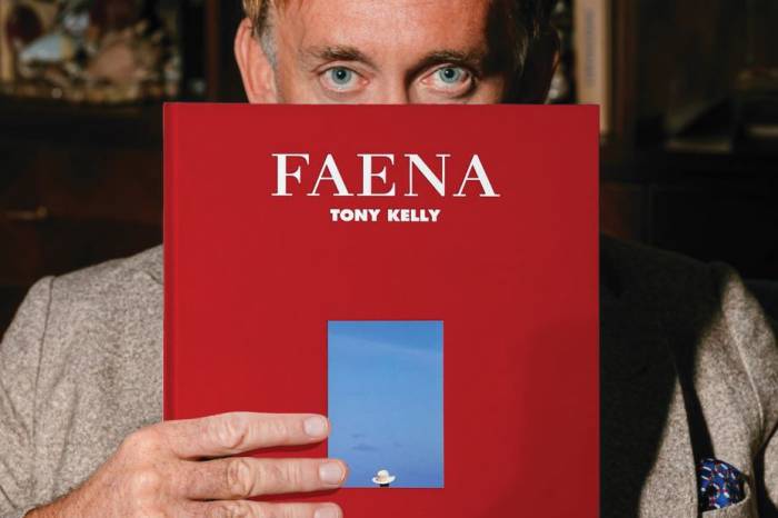
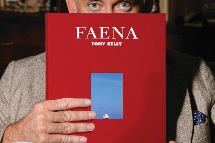
Fine art photographer Tony Kelly, known for his highly polished, playfully subversive images, has his lens fixed on his latest muse, Faena Hotel Miami Beach, to shoot his fourth photobook.
Transforming them into world-class epicenters of art, design, hospitality, wellness and entertainment. This winter, the brand will debut its Key to Miami, a stylish travel guide to the best Miami haunts through a Faena lens.
Tierra Santa Healing House’s dynamic calendar of wellness offerings has expanded to include three-day Pranic Healing workshops, a high-energy spiritual summit at Faena Forum, and new immersive spiritual retreats at Faena Miami Beach.
At Los Fuegos by Francis Mallmann, guests can step up their Sunday brunch game with a genuine Asado experience showcasing a custom eight-foot iron dome used to slow roast flame-licked cuts of beef and market fruits and vegetables.
Paula Selby Avellaneda, founder and curator of Big Bang, recently added 11.11 / eleven eleven’s menswear to the shop’s exclusive fashion mix. “There’s something very universal and ancient about this brand, but it’s also contemporary and relaxed,” she explains.
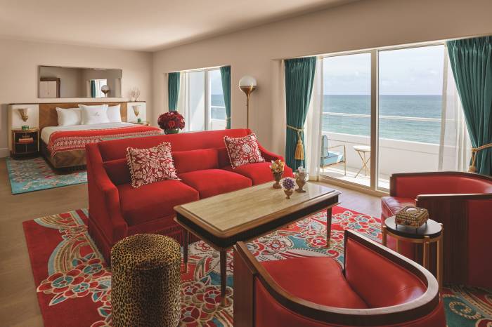
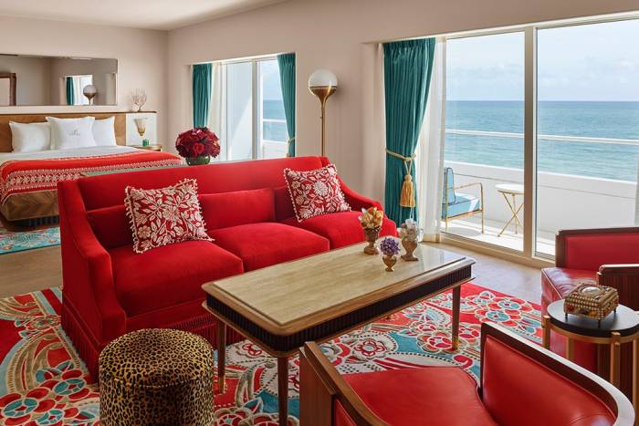
The epitome of Art Deco elegance, the suites are dressed in Faena red furnishings with sumptuous woods and turquoise accents echoing the sweeping sea views beyond. A dedicated butler is on hand to cater to every need, from unpacking services and restaurant reservations to booking spa treatments.
“We’re working on a show that will transcend and transform your ordinary constructions of reality as you enter into the riveting multiverse of Allura,” says Anthony Magliano, founder and creative director of Quixotic.
Miami-based interdisciplinary artist and designer Cornelius Tulloch brings the Project Room to life with Bougainvillea: An Exploration of Adornment—a multilayered site-specific installation that explores Caribbean cultural aesthetics.
“In Mexico, we cook with chilies. It’s our heritage, so you’ll find a whole range of varieties in our dishes,” says Antonio Maldonado, Gitano’s Puebla-born executive chef.
Spread out on a pillow-strewn Bedouin tipi to bask in a sunset Golden Hour while grooving to gypsy-disco and tippling tropical libations like Gitano’s signature Jungle Fever, muddled with cilantro, chili and lime; Connie Girl, a bright mix of basil-and-cucumber-infused Haku vodka, agave and lime; and The Queen, whose blend of Monkey 47 gin, lavender-infused honey, lemon and orange juice, goes down wickedly smooth.
“For me, the Living Room is a magical wonderland where people can let their hair down, dance, chill, eat, drink and meet interesting people,” Johnson says. “My goal is to consistently set a tone that allows people to enjoy themselves in an intimate atmosphere where they don’t have to worry about anything.”
Allow expert practitioners to soothe spirit, mind and body with a unique Sacred Warrior treatment ($199). The 60-minute therapy uses ancient healing traditions including Pranic Healing, aromatherapy, sound bowls, and massage to harmonize, balance and revitalize one’s physical, mental and emotional health.
The most thrilling dining experience of the season is unfolding in speakeasy style at El Secreto, a private pocket-sized bar hidden within Faena Miami Beach. The Omakase experience designed by James Beard Award-winning chef Paul Qui blends Tokyo-style sushi and Kyoto-style kaiseki into a distinctive tasting menu that’s prepared and served in an interactive format.
While you ponder the many enticing ways to spend your $200 Suite Dreams resort credit, a dedicated butler is on hand to unpack your luggage and cater to your every need from booking the two 50-minute spa treatments included in the package to arranging a complimentary hour-long personal shopping experience at the Faena Bazaar.
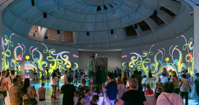
Faena Art is proud to present Roller Rink! Miami’s skate community rolled in style last month at ángeles veloces arcanos fugaces, a participatory pop-up installation on Faena Beach from art collective assume vivid astro focus (avaf) that reimagined a roller dancing rink as an immersive art experience.
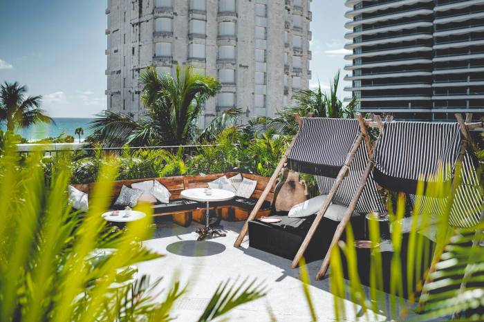
A coconut’s throw from azure Atlantic, Gitano Miami is a see-and-be-seen restaurant and ocean-front rooftop lounge.
In honor of International Women’s Day, Big Bang is spotlighting its array of female designers whose individuality, passion for craft and artistic creations add a bright stroke of beauty to the world.
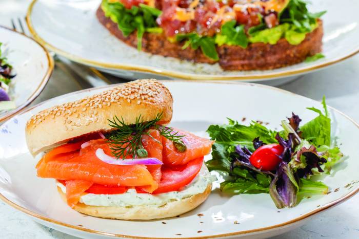
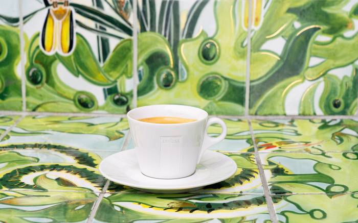
Crema Gourmet is a healthy take on the usual coffee and tea bar. Whether you need a pick-me-up shot of espresso, a beach day lunch, or a hearty weekend brunch, Faena Bazaar’s Crema Gourmet has got you covered.
The new year brings new music, new faces and new experiences to the Living Room.
The Miami Art Week collaboration between Faena Hotel and Miami-based contemporary artist Edouard Duval-Carrié was so well received it will remain on display in Faena Library for guests to enjoy through the spring season.
The start of a new year offers each of us time to refresh, reflect and realign with our purpose.
Faena Hotel’s signature restaurants prepare locally sourced, quality ingredients using globally inspired culinary styles.
Faena Theater spotlights a cast of powerhouse female performers who are redefining the art of burlesque for the modern era.
Faena’s celebrated Jazz Series is back for its fourth annual season, which promises to be its greatest yet. Artist and record producer, Rachel Faro, has curated a lineup of Grammy-nominated musicians for six monthly shows at the intimate Faena Theater.
Grammy Award-winning singer/songwriter, Polina, just released her latest single “Faena,” an uber-catchy ditty penned by the Russian-born LA-based artist during a recent holiday at Faena Miami Beach.
Last year, Faena invited photographer Tony Kelly to create a new series of works based on the life and style of Faena Miami Beach. The result is a stunning artistic magazine featuring over 40 works by Kelly.
Faena Art has selected local environmental artist and educator Beatriz Chachamovits as the first artist to create a site-specific exhibition for the Project Room’s 2022 season. The interactive installation addressing climate change, coral bleaching and plastic pollution will be on public view from April through June.
Documentary filmmaker and lifelong Miamian Billy Corben—with his cutting humor and unparalleled energy—engaged members in a night of storytelling about his six-part docuseries,
Faena Bazaar has added Crema Gourmet Espresso Bar to its mix of upscale offerings including Curio’s coveted selection of lifestyle fashion brands, one-of-a-kind home décor and beauty salon services.
The holidays are upon us and Curio at Faena Bazaar is a one-stop shop for exclusive apparel and accessories, eyebrow and lash services, holiday gifts and fashion-forward Miami Art Week events.
The holiday season is a time for reflection and reconnection. Tierra Santa Healing House offers a wealth of treatments that combine cutting- edge technology and ancient energetic practices to look and feel your best.
Every era has legendary figures who ignite the cognoscenti’s imagination by dreaming far beyond anyone before them, and in the world of urban revitalization that visionary is Alan Faena.
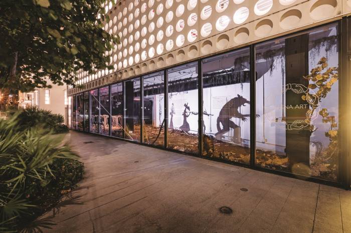
Faena Art is proud to announce the opening of the Project Room. This location marks the first dedicated space for the nonprofit organization in Miami, serving as a platform for experimentation and development of innovative ideas.
During Miami Art Week in December, the nonprofit is collaborating with international artists to host an immersive site-specific art installation on Faena Beach and will inaugurate its first dedicated physical space in Miami.
“We didn’t come out of quarantine to sit in a quiet boardroom,” snaps Cunning to the still buttoned-up circle of theatergoers surrounding them— slowly reeling them into the palm of their hand where...
A fan-favorite on the jetset circuit, GITANO Miami Beach welcomes friends flying in to cavort in warmer winter climes. Known for its stylish gathering spots in Tulum and New York City, Grupo GITANO effortlessly marries a gypsy-chic aesthetic with elevated
The nightlife lounge tends to fly under-the-radar thanks to its penchant for exclusivity.
“The holidays are all about family, celebrating and sharing joy,” said Kaiwen Chen, Pao’s executive chef. “Here at Pao, we are a family-style restaurant with modern Asian cuisine that adds a unique touch to spending quality time with loved ones.”
The mistress of the modern Moulin Rouge has solidified herself as the top-billing burlesque queen holding court around the world, from the glittering Parisian Burlesques to the decadent Weimar German Cabarets.
“It’s all about curation,” says Richard Filippi, Faena’s VIP nightlife director. Music is paramount. Faena’s live entertainment manager Alejandro Lista is always on the hunt for acts that are unique...
The weekend-long event kicked off on June 12 on Faena Beach and continued June 13 in the evening. Faena Art partnered with like-minded nonprofit organizations Blue Scholars Initiative and ARTSail...
Curio at Faena Bazaar has transitioned from pop-up to permanent. The multisensory, multistory retail space has reopened with a range of emerging new brands, exclusive experiences, and singular pop-ups...
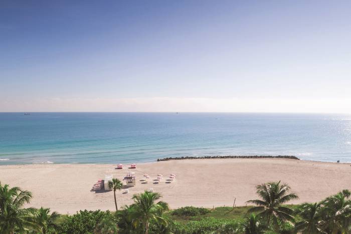
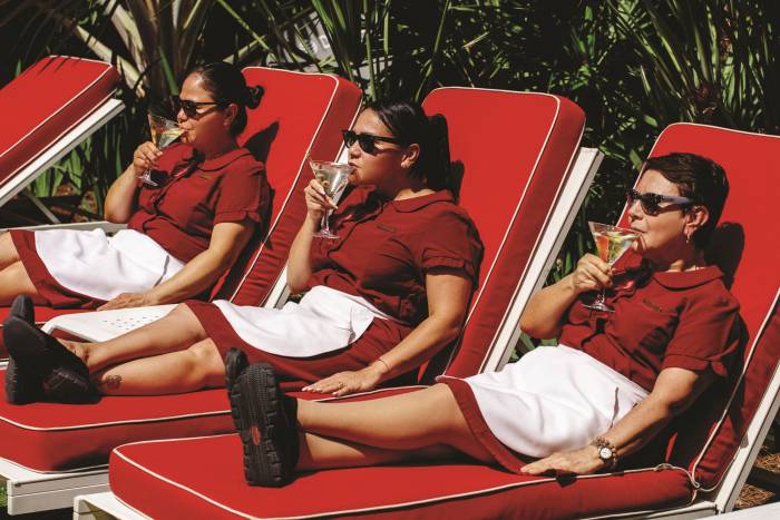
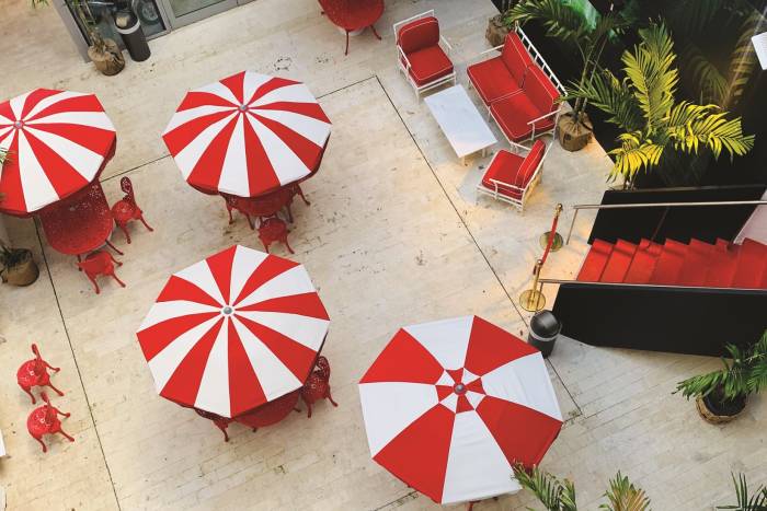
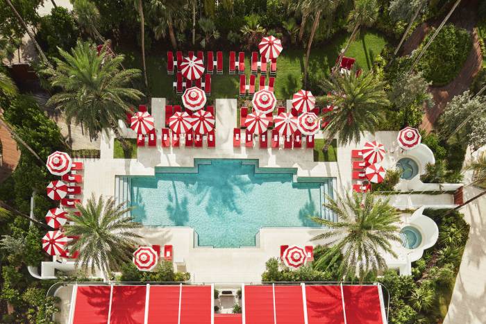
Make the most of summer lounging under Faena’s photogenic red-and-white striped parasols and plush cabanas set on 100,000 square feet of powder-sand paradise exclusive to hotel guests. Soak up the...
Join us in supporting those impacted by the devastating building collapse in Surfside, Florida. Our collective thoughts and hearts are with the families and individuals affected by the tragedy at...
It's time to cruise in the fast lane. Much like Faena, Alfa Romeo strives for perfect harmony between beauty and purpose, passion and technology, emotion, and engineering, in order to create true...
During July and August guests can tend tattered nerves at Tierra Santa Healing House with a thoughtful selection of specially priced body therapies and salon services, as well as fitness, yoga, and...
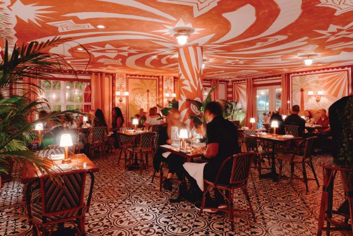
- Published 2023. A tropical oasis of lush greenery and bohemian brio, Gitano brings an air of Tulum to South Beach with delicious food, Latinleaning libations and spirited diversion. As the sun...
ARTICLE ORIGINALLY PUBLISHED IN FAENA JOURNAL ISSUE #46 • DECEMBER 2021 With a shared passion for excellence and a spirit of inventiveness, the fourthgeneration Italian coffee company Lavazza and the...
Mallmann protégé Argentine chef Sebastián Benítez has crafted a summer menu that focuses on simple, fresh ingredients. Chef suggestions range from crispy artichokes sprinkled with sesame and sourdough...
In the amber glow of tapered candles, a polished coterie of guests nestles around tables spread with truffle and champagne risotto, seared prime steak and yellowfin oshizushi. “The dishes are...
Late last January, while the world weathered the enduring grip of the coronavirus pandemic, an exciting announcement emerged from the hotel industry, a sector especially decimated by the impact of...
Alan Faena has partnered with Argentine couture designer Paula Selby Avellaneda to bring a supernova of style to Faena’s Tierra Santa spa boutique in the form of Big Bang, a retail shop featuring one...
Faena Theater Presents A New Journey Into Suggestive Tales of Love and Seduction Faena Live is pleased to announce Tryst – A Lovers’ Rendezvous, an original new production presented by Alan Faena in...
FAENA HOTEL MIAMI BEACH is proud to announce that it is has become Sharecare Health Security VERIFIED™ with Forbes Travel Guide. The comprehensive facility verification helps ensure that guests and...
Forbes Travel Guide (“FTG”), the only global rating system for luxury hotels, restaurants and spas, today announced its 2021 Star Awards. FAENA HOTEL MIAMI BEACH earned a new Forbes Travel Guide Five...
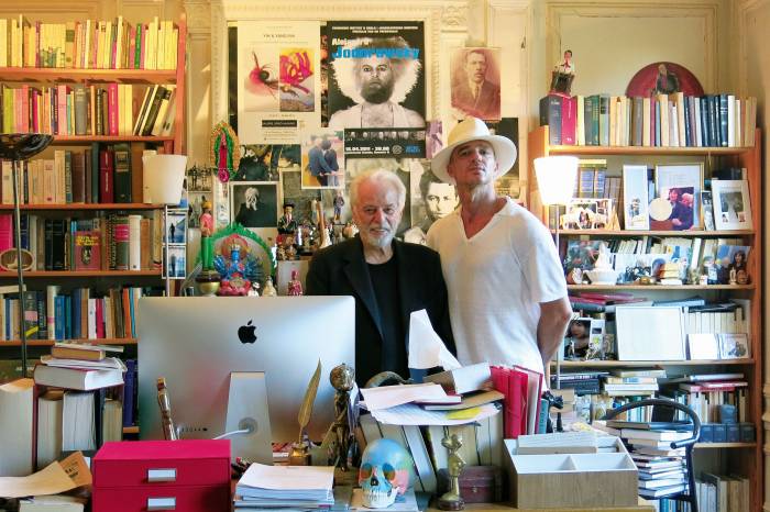
A look inside the imagination of Cuban artist and Dreaming with Lions mastermind, Alexandre Arrechea
Voted by the people, for the people, Faena Hotel Miami Beach and Faena Hotel Buenos Aires is making a lasting impression around the world.
Jamilah Sabur, Suzi Analogue, and Paperwater will work in-residence at the Faena Forum, transforming the OMA designed building into temporary artist studios.
Alan Faena and Accor announce the Launch of a Global Strategic Partnership to Expand the Faena Brand Around the World. "Faena Districts are shifting the gravitational centers of the cities where they reside, making a true difference in their communities." —Sébastien Bazin, Chairman and CEO, Accor
Faena Rose is our art and culture-based private members club, which brings together a dynamic community of like minded individuals.
A look inside the genius of Pao's Chef de Cuisine, Benjamin Murray
From December 2 through 8, 2019, Faena presented its highly anticipated second annual Faena Festival during Miami Art Week.
Making your winter getaway plans have never been easier. Unwind where sunshine restores, ocean air refreshes and five-star service relaxes with the exclusive One-Click Miami Weekend from Blade. This...
Brace yourself for a spellbindingly sadistic story based on the critically acclaimed film by Peter Greenaway, and brought to life by reimagined pop music, riveting dance, and outstanding food and...
Winter Music Conference, now officially part of Miami Music Week, returns to Faena Forum this March 25-28 for its 34th annual edition.
Since its opening in 2004, Faena Hotel Buenos Aires, designed by Philippe Starck, has redefined the experience of travel and inspired living by merging the elements of art, culture, entertainment...
We created a unique treatment combining different modalities so our guests could have a greater experience of our wellness philosophy —said Spa Director Agustina Caminos. “Tierra Santa Healing House...
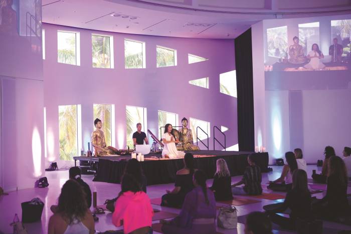
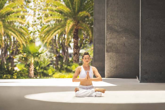
The Sanskrit scripture, The Bhagavad Gita, tells us that “yoga is the journey of the self, through the self, to the self.” Tierra Santa’s skillful instructors lead guests through the ancient practice...
Locals coming to stay are treated to daily complimentary breakfast for two as well as a $25 resort credit to put towards sundowners on the terrace at the hotel’s First Call happy hour or enjoy a...
Maison St~Germain comes together with artists for installations at Gitano at Casa Faena and Tree of Life at Faena Hotel Miami Beach for Miami Art Week.
"I had a field day writing this song," shares music icon Boy George on his original theme song for The Cook, The Thief, His Wife & Her Lover open now at Faena Theater.
Faena Bazaar’s new collaboration with Curio brings a curated design collection, and exclusive pop ups to our neighborhood.
While Gitano was born in the jungles of Tulum as a gathering place for the sun-kissed jetset to dine and dance, the brand has been quickly expanding in New York, and most recently Miami.
Plus a new show at Guest Gallery Dot FiftyOne. While last month’s installation at Faena Bazaar Lobby hinged around Miami Music Week with an eye-catching art installation of wall-to-wall CDs beckoning...
This year, Faena is partnering with the legendary Italian automaker by rechristening its OMA-designed Faena Park building as Alfa Romeo Faena Park. The state-of-the- art parking structure, which...
This April, Faena Rose is delighted to host America’s leading Latino dance organization, Ballet Hispánico, for an exclusive performance followed by a Q&A with Artistic Director & CEO Eduardo Vilaro...
The Lady & The Sailor It all starts with the essentials. That’s what inspired designer Brittany Correy over a decade ago to launch The Lady & The Sailor based on her philosophy that “good basics are...
Step into a fantastical world where the lines blur between artist and audience. Part cirque nouveau, part dance rave and part Magic City, the new Nocturne series at Faena Theater is serving up an all...
Guest Galleries at Faena Bazaar Published in 2019 Guest Galleries —a new series of installations in Faena District curated by Faena Art— will launch on Friday, February 15th with DotFiftyone as the...
Flaming Hearts For Valentine’s Day, whisk your significant other away to Faena Miami Beach and enjoy a curated experience designed to fan the flames of your kindred heart. Slip away from the outside...
The spa itself and our monthly programs are designed to uplift the spirit, heal the emotional and physical body, and help guests connect to the highest level of existence. —said Spa Director Agustina...
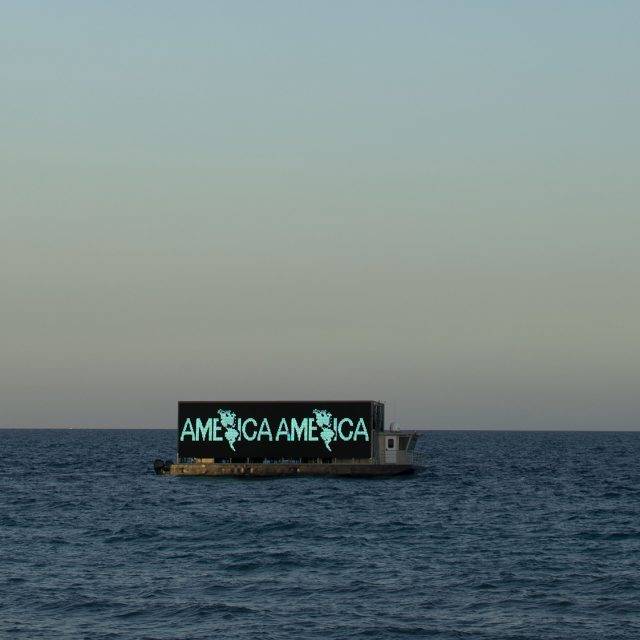
The first-ever Faena Festival in Miami Beach invited the community to contemplate the concept of America through experimental installations and performances that explored the multiplicity of communities and cultures across the continent.
A Perfect Pairing Sommelier Dragan Culibrk dishes on what to pair with Los Fuegos’ winter menu. “A gourmet meal without a glass of wine just seems tragic to me somehow,” professed American country...
Celebrate Faena’s South American roots at Los Fuegos with Christmas and New Year’s Eve dinner menus resplendent with grilled delights. Dashes of Faena’s signature red accent the restaurant’s crescent...
The nation’s top celebrity chefs are sharpening their knives and heading to Miami’s 18th annual South Beach Wine & Food Festival ®. Over 90 culinary events will be sating foodies across the city from February 20 through February 24, 2019.
Building upon parades, carnivals, and other public ceremonials from across the Americas and the Caribbean, Tide by Side inaugurated the Faena District Miami Beach with new commissions and American premieres of works by an international cast of artists and performers.
Faena Hotel Miami Beach Voted Number One Property in America and one of the top hotels in the world by Condé Nast Traveler’s 2017 Readers Choice Awards.
Faena is proud to receive five prestigious AHEAD Americas Awards for excellence in hospitality design and experience for its Faena Miami Beach development.
Faena Rose is our art and culture-based private members club, which brings together a dynamic community of like-minded individuals through a robust, year-round calendar of the most engaging and transformative cultural experiences.
Faena Theater draws the curtain on its newest show. Do you have the stomach for revenge? Find out on October 18 during the highly-anticipated launch of Faena Theater’s delicious dinner and theater production, The Cook, The Thief, His Wife & Her Lover.
Dutch duo Studio Drift, in partnership with BMW and Pace Gallery, premiered Franchise Freedom, a performative artwork on the beach of Faena District during Miami Art Week 2017.
When the sun goes down and the curtains come up at Faena Theater, guests are immersed in a fantastical world where the lines between performer and audience are blurred, and anything can happen.
Opening in December, Casa Faena will be the new home to Grupo Gitano’s first Miami outpost. The new Gitano at Casa Faena will dish up a taste of Tulum and the Yucatán featuring signature tropical vibes, gipsy-disco sounds, refreshing cocktails and Mexican flavors.
Spend a memorable night with your heart’s desire at a tantalizing showing of Samsara.
This year’s Miami Music Week was one for the books with a new iteration of the Winter Music Conference debuting at Faena Forum and a variety of incendiary performative installations presented by Faena Art.
As the Faena Festival combines art and technology, art and faith, and art and food, Tierra Santa Healing House participates in Miami Art Week through the marriage of art and wellness
On December 2, the world’s reigning Queen of Pop delivered an evening of unmatched art and entertainment in the name of charity, securing $7.5 million to benefit Raising Malawi.
Amidst the hustle and bustle of Miami Art Week, guests had the opportunity to retreat to Tierra Santa Healing House to relax and rejuvenate in ultimate style.
Keeping with its mission to serve the community through the arts, Faena Miami Beach is a proud sponsor of Miami Dade College’s Miami Film Festival (MFF), an annual ten-day festival that showcases over one hundred independent American and international films in venues across the city.
Faena Art presents “Melodies of Certain Damage (Opus 2)”, a new sonic and immersive, site-specific exhibition by Israeli artist Naama Tsabar.
Opening in December, be immersed in a multisensory and multistory journey of discovery weaving together of-the-moment designers and must-see art installations thanks to Faena Bazaar’s new collaboration with Curio.
An evening of auditory and visual elevation by artists and musicians who moved fluidly between and across disciplines towards visuals scores and sonic experiences.
The Faena Festival, which explores the different narratives and mythologies associated with America, debuted on April 8th in Buenos Aires and spread across the city in collaboration with the Semana del Arte and ArteBA, one of the largest contemporary art fairs in Latin America.
While raising a glass to Miami Art Week at Hennessy on the Rocks, Faena Beach Dome’s oceanfront deck featured live DJ performances, immersive artistic projections and innovative craft cocktails. LIVE...
Faena Art added a touch of disco to Miami’s popular III Points independent music festival in February with an artist-designed roller skating rink open to the public.
Faena Live’s original production—Samsara Cabaret—is a transcendent story about the life, death and rebirth of Artemis, the show’s beautiful heroine, told through music, dance, cirque-arts and sensuality.
Take your weekends to the next level with Faena’s lavish Sunday Asado Brunch.
As part of the mission to maintain the culture at the heart of Faena District, Faena Forum hosted Second Sundays on June 11th to celebrate the communities of Miami Beach with ángeles veloces arcanos fugaces, a participatory art installation by assume vivid astro focus that reimagines a roller dancing rink.
Choreographies of Salt was an interactive artwork that revolved around a simulated archaeological discovery of a siren’s skeletal remains found along the banks of Río de la Plata outside the Faena Art...
Spring is a time for clearing space for new beginnings. This March, Tierra Santa Healing House plays host a wide array of workshops and classes from color courses and feng shui to yoga and Pranic Healing.
The culinary use of flowers dates back to China, Greece, and Rome thousands of years ago, but it has always been present in traditions around the world.
The larger-than-life presence of Israeli-born and New York-based performance artist Naama Tsabar graced the Faena Art Center Buenos Aires last month.
In his early 20s, Argentina native Alan Faena discovered a plot of vacant beachfront scrubland near the summer stomping grounds of his childhood—Punta del Este, Uruguay. The remote stretch of land...
Alan Faena, his numerous collaborators, and innumerable community supporters, are delighted to be acknowledged as an integral and essential part of Miami’s arts district.
Raúl de Nieves made a name for himself treating modest materials with meticulous attention and “turning the mundane into the fantastical”.
For months, artist Peter Tunney carefully collected giant pieces of the infamous Taj Mahal casino from Atlantic City to convert these ruins into The Sinking of the Taj Mahal, a site specific installation at Faena Playa.
At Faena, wine-making is a celebrated art form that guests can fully appreciate by sampling our exclusive range of private label Malbec wines produced in Mendoza, Argentina.
Leave behind the daily grind and whisk yourself away to the sun-kissed shores of Faena Miami Beach. While you wiggle your toes in the powdery sand and shade yourself under our signature red-and-white...
A biennial international juried prize, the Faena Prize for the Arts recognizes artistic experimentation, encourages post-disciplinary and temporal exploration, and promotes inquiry of the infinite links among art, technology and design.
Throughout his artistic career, Antoni Miralda (Spain, 1942) has harnessed the power of food through rituals, ceremonials, and processionals for over five decades.
Miami Swim Week at Faena District From July 11-18, Faena Bazaar will morph into Coterie: Pop-Up in partnership with Maris Collective during Miami Swim Week. The immersive retail experience will...
Faena Rose, our art- and culture-based private members club, will welcome internationally-acclaimed chef Nina Compton as part of its guest chef dinner series, curated by Rose Founding Member and SOBEWFF Founder, Lee Brian Schrager.
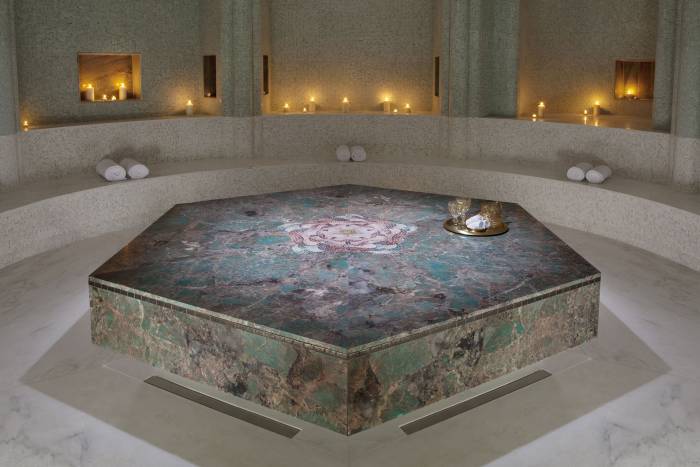
Regarded as the spiritual heart of Faena Miami Beach, Tierra Santa Healing House is a holistic sanctuary dedicated to the art of living well.
Unifying a large swath of Faena’s beachfront is artist Phillip K. Smith III’s 120 Degree Arc East-Southeast, a new iteration of the work he created earlier this year at Desert X in the Coachella...
Exclusive editions include Patron en Lalique tequila, of which only 500 bottles have ever been produced, Avion Extra Anejo Reserve, a tequila aged over 44 months and served in crystal cups, and Casa...
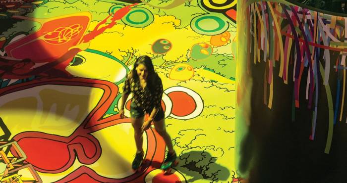
A site-specific experience designed to bring people together through art, imagination and innovation, this famously Instagrammable museum invited guests to lose themselves in a candy-coated world of...
Faena Forum was taken over by two monumental site-specific installations that together convert the entire building into an immersive, multi-sensory experience. Guests of all ages were invited to...
The 3D-mapped projections that composed Ediacaran Mind were invitations for the community to experience contemporary art in the public sphere as an urban architectural intervention. Working mostly...
Cricket Shelter is an urban farming system and temporary shelter that minimizes the ecological footprint of protein-rich food production. It is a well-established fact that industrialized animal...
We believe such a grand romance should be reflected in a way that’s as beautiful as your love story. At Faena, your wedding is more than just an event. It’s a dreamscape. And we are the masters of...
The Art Deco gem is wrapped in slick black marble, gold trim and floor-to-ceiling mirrors carved by the hands of Argentine artist Amaya Bouquet—a veritable Secret Garden to cradle visitors in a...
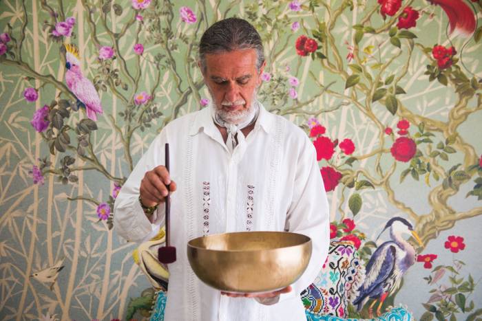
Every month, Eric Lopez will guide guests through the Bert Hellinger-developed Family Constellations methodology, facilitating a powerful healing ritual where each participant inches closer to...
Just in time for Art Basel, Alan Faena officially unveiled the newly completed, 43,000-square-foot Faena Forum.
Readers of Conde Nast Traveler magazine have also named Faena Hotel Miami Beach as the number one hotel in Magic City for a second consecutive year, as well as a top 10 hotel in the United States, while editors at Travel + Leisure have once again placed the hotel on its highly regarded World’s Best Awards list.
Chakra, which literally translates to “wheel” or “disk” in Sanskrit, is a term that refers to the wheels of energy and corresponding nerve hubs located throughout the body. There are seven main...
Peace is always a choice. No matter where you are in life, nor what’s happening around you, you always have the power to choose your response to any given situation. It can be difficult to find the...
While the means of creating a perfect crudo may have changed, the principle remains the same: it’s an artful dance between preparer and materials, relying on the delicate balance of flavors to...
Starting on July 1st, 2017, wellness seekers can enjoy a wealth of beauty and health experiences at a special prices Sunday through Friday at our world-renowned Tierra Santa spa, described as an...
The Miami native, who first discovered her love of singing at the tender age of two, has cultivated her craft in the intervening 19 years, leading her to the opulent Living Room stage at Faena Miami...
Peaceful living pivots around the axis of kindness, compassion and non-harming on every level, from what we eat to how we show up our relationships. Inner peace happens when we live in harmony with...
Offering an exclusive discount on our best available rate, Faena Hotel Miami Beach invites you to wake up to a complimentary American breakfast every morning on our alfresco poolside Veranda before...
Sleek and grand, these one- to three-bedroom residences boast open-plan living spaces surrounded by panoramas of both sea and sky. Each residence is the realized dream of founder Alan Faena and master...
Faena Hotel Miami Beach is humbled and proud to announce that it has maintained its elite status as a Forbes Five Star property. The accolade is a testament to the hotel’s thoughtful service that...
A collaboration with The Centre d’Art Contemporain Genève, the Biennale of Moving Images attracted thousands of people during its opening night at Faena Bazaar where guests got a first glimpse of 28...
Alan Faena believes in the transformative power of the arts and continually seeks to provide a platform to interdisciplinary artists from around the world to showcase their work. In keeping with this...
Chosen for his exceptional artistic vision, Juan Gatti designed the dome in an effort to take art off the wall and onto a setting that enveloped the audience and captivated their imaginations...
The Tierra Santa fitness facility blends sophisticated training and smart technology in the purest and simplest of settings. Each day our team of experts will be waiting to offer a new beginning, challenge, or opportunity to change your life, improve your health, or enhance your body.
Tierra Santa Healing House combines ancient healing techniques with cutting clinical technology. For use in the spa’s signature facial treatments, we have handpicked the French skincare line...